Fishfinder/GPS advice

SHickey

Petty Officer 1st Class
Joined
Apr 29, 2011
Messages
263
Hello all,

I have a "new to me" open bow 19' Bluefin I/O and would like to install a fishfinder/gps. I am willing to spend @ $400-$500 for a unit that I can use in the NYS Adk Mts specifically on Stillwater Reservoir. This reservoir is a beautiful body of water BUT there are hundreds of submerged hazards all over the place which are not marked. I so do not want to to ruin my OMC LU by hitting one of those rocks or shoals.

Does anyone have any ideas for me and my price range? I am not an electronics or technology geek and for me the unit should be simple to learn and operate. I have researched several systems BUT I hear some nightmares about how some units have limited information regarding depths and bottom contour which can make for a hazardous ride.

I appreciate any information and insight for this decision.

Thanks in advance

SH
 

DesertHunter

Cadet
Joined
Dec 17, 2012
Messages
9
Re: Fishfinder/GPS advice

I also am looking and am giving serious consideration to this one. "Lowrance Elite 4 Dsi Chartplotter/fishfinder Combo With Transducer". The reviews seem to be good and the price is in the ballpark.
 

cajunblaze

Recruit
Joined
Jan 8, 2013
Messages
2
Re: Fishfinder/GPS advice

I also am looking and am giving serious consideration to this one. "Lowrance Elite 4 Dsi Chartplotter/fishfinder Combo With Transducer". The reviews seem to be good and the price is in the ballpark.

I just bought the elite 5 dsi for 397 is th eprice on iboats.
 
Last edited:

Bondo

Moderator
Staff member
Joined
Apr 17, 2002
Messages
71,079
Re: Fishfinder/GPS advice

Hello all,

I have a "new to me" open bow 19' Bluefin I/O and would like to install a fishfinder/gps. I am willing to spend @ $400-$500 for a unit that I can use in the NYS Adk Mts specifically on Stillwater Reservoir. This reservoir is a beautiful body of water BUT there are hundreds of submerged hazards all over the place which are not marked. I so do not want to to ruin my OMC LU by hitting one of those rocks or shoals.

Does anyone have any ideas for me and my price range? I am not an electronics or technology geek and for me the unit should be simple to learn and operate. I have researched several systems BUT I hear some nightmares about how some units have limited information regarding depths and bottom contour which can make for a hazardous ride.

I appreciate any information and insight for this decision.

Thanks in advance

SH

Ayuh,.... I know the water quite well,... Yer Right, it's a hazard prone spot....

Just don't get to comfy just because ya got a fish finder,...
Sonar tells ya what the bottom looks like, where you've Been,....
Not where yer headed....

A sonar will tell ya there's a rock there, 'bout the same time the lower unit hits it...
 

SHickey

Petty Officer 1st Class
Joined
Apr 29, 2011
Messages
263
Re: Fishfinder/GPS advice

Thank you all for the input. The Elite 4 or 5 were both on my short list as solid possibilities. A quick question to Bond-o: being familiar with Stillwater Res, are there specific nav cards or pre-loaded maps that display a pretty accurate topography of the bottom or is the information regarding this body of water generic and pretty basic?

I am also contemplating mounting the transducer on the bottom of my boat instead of the stern to give me a second or two of reaction time before an immanent collision with a submerged hazard. What are your thoughts on that? Or am I getting a nasty dose of cabin fever over-analyzing this whole operation??
 

Georgesalmon

Lieutenant Commander
Joined
Apr 14, 2012
Messages
1,793
Re: Fishfinder/GPS advice

By putting the transducer on the bottom instead of the transom the reaction time probably won't help. Even at trolling speeds by the time you see something it will be to late to do anything but swear. There are other good reasons for mounting the transom on either place but reaction time isn't one of them. JMHO
 

Bondo

Moderator
Staff member
Joined
Apr 17, 2002
Messages
71,079
Re: Fishfinder/GPS advice

Thank you all for the input. The Elite 4 or 5 were both on my short list as solid possibilities. A quick question to Bond-o: being familiar with Stillwater Res, are there specific nav cards or pre-loaded maps that display a pretty accurate topography of the bottom or is the information regarding this body of water generic and pretty basic?

I am also contemplating mounting the transducer on the bottom of my boat instead of the stern to give me a second or two of reaction time before an immanent collision with a submerged hazard. What are your thoughts on that? Or am I getting a nasty dose of cabin fever over-analyzing this whole operation??

Ayuh,.... I don't go there often, but occasionally,...
A close ole Bud has been runnin' the get-away at the 2nd island out, to the right(southeast) of the boat launch, at the Hotel...

I don't have any idea who might have the best charts,...
I try to follow the water-taxis when I'm unsure....
 

fishrdan

Admiral
Joined
Jan 25, 2008
Messages
6,989
Re: Fishfinder/GPS advice

Do some research on the maps available for the sonar/GPS units you're looking at buying. I recently bought a Humminbird and while the GPS is accurate, the map has NO bottom contour detail, at all... The Navionics map is another $150+- and in my area the maps are supposed to have 1' graduations, not all locations have highly detailed maps. Navionics has a listing of lakes with high resolution maps and it might be worth a look-see to see if that lake is offered in high resolution.

When I was asking about GPS and maps here, several guys said Garmin maps are the best. I'm not sure on that, but though I'd throw it out there.
 

D1vemaster

Cadet
Joined
Jan 23, 2013
Messages
22
Re: Fishfinder/GPS advice

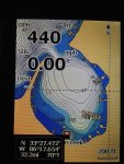
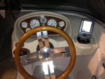
I just installed a Lowrance Elite 4 (not DSI) , seems to be nice, will find out when I get on the water
this spring. Resolution looks ok so far. Navionics Premier appears to have good depth contours. I doubt it has
many rocks, still need to know where your going.

IMG_0653.jpgIMG_0646.jpg
 

SHickey

Petty Officer 1st Class
Joined
Apr 29, 2011
Messages
263
Re: Fishfinder/GPS advice

Thank you all again. You all have given me some great advice and I will let the Forum know what my final choice was.

SH
 

jhebert

Ensign
Joined
Jul 24, 2005
Messages
903
Re: Fishfinder/GPS advice

I am willing to spend @ $400-$500 for a unit that I can use in the NYS Adk Mts specifically on Stillwater Reservoir. This reservoir is a beautiful body of water BUT there are hundreds of submerged hazards all over the place which are not marked. I so do not want to to ruin my OMC LU by hitting one of those rocks or shoals.

The first problem to resolve in your search is finding a source of good digital cartography for your lake that has accurate and detailed soundings. Having found the necessary digital chart, you will then likely be constrained in your choice of chart plotters that can use that data. Pick the digital chart first, then find a chart plotter that can use those charts.
 

SHickey

Petty Officer 1st Class
Joined
Apr 29, 2011
Messages
263
Re: Fishfinder/GPS advice

CPO,

That is great advice and I am finding out that different systems have different digital chart capabilities. That being said, are there any Adirondack Mountain boaters that could recommend the best digital chip for these bodies of water in the northern part of NYS?? My choices for chips are Navionics, Fishing Hot Spots, or Lake Master.

I believe my final choice for a fishfinder/ gps system will be the Lowrance elite 5. That choice is still dependent on which chip gives me the best coverage in the Adk area.

SH
 
Top