GPS question

mrmamiller

Petty Officer 2nd Class
Joined
Mar 7, 2011
Messages
167
I'm looking to replace an older Garmin GPS which has failed intermittenty, probably due to heat (sunshine). I'm looking at a Garmin 541S. The info available says "preloaded with all U.S. coastal areas". I'm boating in Southwest Florida, mostly inland waters, but may venture out into the gulf up to 10 miles. My boat is small, 17 ft CC. Does anybody know if the preloaded maps cover these areas? I'm not interested in the images that you get from (BlueChart 2G) 3D, satellite imagery, etc. Just want up-to-date maps.

As an "also", I boat on Lake Erie and would be taking the unit back North for my other boat. Wonder if Lake Erie is also on the GPS by default, or whether I need to purchase a map.

Thanks, Mark (glad I'm in FL and not back in PA!)
 

dingbat

Supreme Mariner
Joined
Nov 20, 2001
Messages
16,313
Re: GPS question

The preloaded "coastal maps' on Garmin units are the Bluechart 2G. The bells and whistle charts are the Bluecharts G2 Vision.

I can't comment on Lake Erie, but the coastal charts are more than adequate for the coastal US. Bluechart 2G charts are the equivalent of Navionics Gold or better.
 

UncleWillie

Captain
Joined
Oct 18, 2011
Messages
3,995
Re: GPS question

I have a Humminbird, but the maps likely come from the same source.

The "Base" Maps on Lake Erie can be spotty.
Lorain harbor is highly detailed.
Cleveland harbor is nearly blank inside the break-wall. Go Figure. ???
The lake itself is reasonably detailed.

The upgrade Navionics maps ($75) carry more information than I can use.

Specifically, what part of Lake Erie and Exactly where in Florida are you interested in?
I'll post a screen shot of the GPS.
 
Last edited:

mrmamiller

Petty Officer 2nd Class
Joined
Mar 7, 2011
Messages
167
Re: GPS question

Willie, I'm looking for Southwest Florida in detail in the sounds and bays, Gulf out to 20 miles. More precisely, from Port Charlotte down to Bonita Beach. On Lake Erie, around the Erie area between the NY and OH state lines out to the Canadian border
 

OllieC

Chief Petty Officer
Joined
Dec 8, 2011
Messages
535
Re: GPS question

I had to order the BlueChart maps for mine because it didn't give me buoy's , depth, etc. It just showed that I was on a body of water. I bought the chart (mine was a disc) along with a chip reader to install the maps. I ended up selling the unit last year and purchased a newer larger unit from a different manufacturer .
No complaints once I downloaded the charts though.
 

ssobol

Chief Petty Officer
Joined
Sep 3, 2010
Messages
503
Re: GPS question

I'm looking to replace an older Garmin GPS which has failed intermittenty, probably due to heat (sunshine). I'm looking at a Garmin 541S. The info available says "preloaded with all U.S. coastal areas". I'm boating in Southwest Florida, mostly inland waters, but may venture out into the gulf up to 10 miles. My boat is small, 17 ft CC. Does anybody know if the preloaded maps cover these areas? I'm not interested in the images that you get from (BlueChart 2G) 3D, satellite imagery, etc. Just want up-to-date maps.

As an "also", I boat on Lake Erie and would be taking the unit back North for my other boat. Wonder if Lake Erie is also on the GPS by default, or whether I need to purchase a map.

Thanks, Mark (glad I'm in FL and not back in PA!)

I had the 400 series Garmin. The preloaded maps aren't that great. You're probably better off buying the one without the maps and then buying a map chip (that's what I did). That way you don't pay for maps that you don't use (or pay for them twice).
 

tav

Petty Officer 1st Class
Joined
Feb 8, 2008
Messages
239
Re: GPS question

i have a gramin 421 and it came with a sd card when i bought the boat for the ct. river ,long island sound and and many other places, it's great to picks up depth,rock formations,channel markers. you can chart with it but i have no use for charting. great gps
 

UncleWillie

Captain
Joined
Oct 18, 2011
Messages
3,995
Re: GPS question

Willie, I'm looking for Southwest Florida in detail in the sounds and bays, Gulf out to 20 miles. More precisely, from Port Charlotte down to Bonita Beach. On Lake Erie, around the Erie area between the NY and OH state lines out to the Canadian border

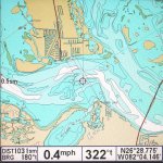
Here are some screen shots from my Humminbird GPS. Other GPSs will be similar.
It has the Navionics EAST card installed, It does not have any charts South of South Carolina so the Florida Pic is the included Base map.

This is the West side of the Erie, PA harbor entrance showing the Base Map compared to the Navionics card.
All water shown in Blue is less than 10 feet deep.

EriePA Entrance.jpg

And this is the included Base chart of the Chanel between Pine Island and Sanibel Island at the south end of Pine Island Sound.
It shows reasonable contours but does not include any depth soundings. To be fair, some areas farther inland did display Depth soundings. As stated, the base maps are often sufficient, but sometime spotty, depending on where you boat and and the luck of the draw.

PineIslandSound.jpg
 
Last edited:

mrmamiller

Petty Officer 2nd Class
Joined
Mar 7, 2011
Messages
167
Re: GPS question

UncleW, thanks for the screen shots. I'm surprised that the base map has the detail that it does. The Pine Island Sound base map might even be enough to keep from running aground even without the sounding numbers. For now I think I'm putting a GPS purchase on hold. I leave Florida in another 5 weeks and I found a poor ground connection which was responsible for my existing GPS failing intermittently. Thanks for the info. Mark
 
Top