


Re: Florida Get Together 2010
here is a link for google...follow Palm St in off Ft Island Trail ( 44 ) that entire thing is the park ( the park looks like a sub division, but those are RV not houses ), if you look to the right side you see the canal and the docks for those sites.
http://maps.google.com/maps?hl=en&ie=UTF8&ll=28.900199,-82.624086&spn=0.004245,0.010986&t=h&z=17
and the chart view.....water depths are way off
.
http://demo.geogarage.com/noaa/?lat=28.90314862571331&lon=-82.65460968017578&zoom=13
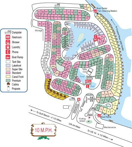
wish they had a site map on line, to see the lay out.
here is a link for google...follow Palm St in off Ft Island Trail ( 44 ) that entire thing is the park ( the park looks like a sub division, but those are RV not houses ), if you look to the right side you see the canal and the docks for those sites.
http://maps.google.com/maps?hl=en&ie=UTF8&ll=28.900199,-82.624086&spn=0.004245,0.010986&t=h&z=17
and the chart view.....water depths are way off
.
http://demo.geogarage.com/noaa/?lat=28.90314862571331&lon=-82.65460968017578&zoom=13
 I guess you could buy a motor home, that would solve it all.